Post Summary
-
Date
27 November 2012, 10.38 AM
-
Posted by
Admin
-
Posted on
Tourist
-
Comments
0
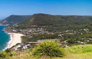
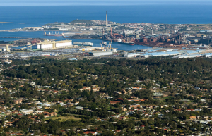
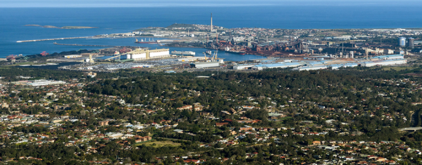
Mt Keira Lookout
Mt Keira Lookout offers the most panoramic, breathtaking view from the southern NSW area. Mount Keira is a 463.9 metre high mountain lying 4 kilometres north-west of the city of Wollongong. Its distinctive shape and proximity to Wollongong make it a major local landmark. It is noted for the views of the city from the popular summit lookout and its history of coal mining. It was formed as part of the Illawarra escarpment fold between 80 and 60 million years ago and the erosion by creeks that ensued.
Mount Keira is also the name of the suburb that includes the mountain’s summit and southern flank.
Keira is an indigenous Australian term meaning ‘large lagoon’ or ‘high mountain’. The Aboriginal people called it ‘Djera’, meaning ‘wild turkey’. The first maps of the area called it ‘Keera’, later adding the ‘i’. The mountain is usually pronounced Kee-rah. Keira is also the name of the local government area including the mountain and an area of Wollongong’s suburbs. Mount Keira is also the name of the suburb on the mountain’s southern flank, not to be confused with Keiraville on it’s eastern foothills.
Mount Keira forms part of the Illawarra escarpment which it joins by a high saddle on the back (western) side. It is capped by a westward sloping plateau of relatively hard sandstone ringed on the remaining 3 sides by cliffs. From the cliff base the mountain slopes down to the surrounding foothills and coastal plain. From Wollongong the mountain looks rather flat topped; while from the north it appears part of the escarpment.
The majority of the mountain is forested with eucalypt (sclerophyll) forest and sub-tropical rainforest, while civilization encroaches on the lower slopes. Surrounding suburbs are (from north to south): Balgownie, Mount Pleasant; Mount Ousley; Keiraville; West Wollongong; Figtree and Mount Kembla.